DavaoGo: Jeepney route planner for Davao City commuters
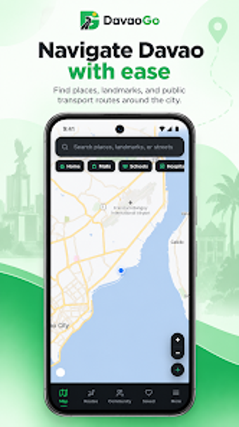
Maps of jeepney routes, point-to-point trip planning, and fare estimates form the app's core navigation features, helping commuters pick routes and stops with live GPS cues. Created by Francisco Navalta as an Android maps-gps tool, DavaoGo presents route search, fare calculation, and GPS-based stop detection in a compact interface. It fits daily riders, students, and visitors who need localized jeepney routing and straightforward trip guidance across Davao City.
Focused mapping for the city's jeepney network
DavaoGo centres on a database of local jeepney routes and a trip planner that accepts a start and end point to return transit options, a capability the app advertises as its primary function. The route search and trip planning address gaps in global mapping by listing jeepney paths and estimated fares, which the developer tailored specifically for the Davao City commuting environment.
GPS integration gives live location and stop awareness
The app uses GPS integration to show nearby jeepney stops and track progress along a selected route, providing real-time positioning inside the interface. That GPS use means the app can show where a rider is relative to mapped routes and calculate estimated fares based on the selected path and local fare rules embedded in the system.
Android-first delivery with a web fallback for wider access
The developer supplies an Android build via the Google Play Store and a web app version for cross-platform access, so mobile users get native access while iOS or other-device users can consult the web interface. The connection model is standard mobile app behaviour, requiring device GPS permissions to deliver location-aware features without device modification.
Designed for everyday commuters, with local refinement and limits
Navalta built the app from local knowledge and beta feedback to keep route accuracy and fare relevance aligned with city conditions, which suits students, workers, and tourists. The app targets city transit use and does not claim wider national coverage; users are responsible for ensuring their use complies with applicable platform terms and local regulations when relying on simulated or reported location data.
Practical local tool for navigating Davao's jeepney system
DavaoGo is a pragmatic option for anyone who needs focused, locally mapped jeepney routes and quick fare estimates within Davao City. The app's live GPS stop detection and point-to-point planner make it useful for daily commutes and short visits, while the Android-first delivery and web alternative keep access broad. Expect a city-focused utility rather than a general-purpose transit platform.